
Cos'è
The "In the Spotlight" series features double sessions of two 20-minute presentations, each followed by a 10-minute open dialogue and Q&A. Designed to introduce new colleagues to the broader FEM research community, these sessions offer a platform for team members to share their scientific backgrounds, present active projects, and showcase specialized technical skills. For this session In the Spotlight session, we are pleased to introduce Dr. Roberto Zorer and Dr. Thomas Maffei. Anyone interested is warmly invited to attend.

Dr. Roberto Zorer serves as a Senior Researcher in the Digital Agriculture Unit at Fondazione Edmund Mach (Research and Innovation Centre), where he focuses on smart agriculture, automated phenology monitoring, and early detection of plant water stress using low-cost dataloggers and LoRaWAN technologies. He previously worked as a Contract Researcher at Centro di Ecologia Alpina, building extensive experience across ecophysiology and plant physiology. Dr. Zorer holds a Ph.D. in Plant Physiology from the University of Salzburg (Austria) and a Master's degree in Biological Sciences from the University of Padua (Italy). Qualified as an Associate Professor (ASN 07/B2) in Arboriculture and Forest Systems, his primary expertise lies at the intersection of precision viticulture, Geographic Information Systems (GIS), and climate change scenarios. His research background encompasses applications in vineyard microclimate analysis, thermal infrared sensing, light profiles, and Internet of Things (IoT) solutions for agricultural management.
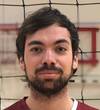
Thomas Maffei serves as a Researcher in Digital Agriculture at the Research and Innovation Centre of Fondazione Edmund Mach, where he focuses on developing and applying to Earth Observations data geostatistics solutions and machine learning techniques to the agriculture sector. He previously worked in the private sector as responsible for aircraft and UAV surveys across Europe, data preparation and analysis of hyperspectral sensors. Thomas's research background encompasses applications in GIS and remote sensing for forestry, highland pastures, urban and environmental monitoring, with a current focus on high resolution satellite time-series applications.